
douG
-
Posts
2,693 -
Joined
-
Last visited
Content Type
Events
Profiles
Forums
Store
Everything posted by douG
-
Here's another. Road Map of Ontario. Remember that it would take about 21 hours at 100 km/hr to go from east to west boundaries of Ontario, and you would see lush farms of wheat, corn and barley, and cattle ranches great flats and rolling hills. You would also see some of the most rugged and beautiful lakes and rivers, inland seas. There are also large cities and heavy industry and kulcha. East to West by Google. Dont forget to click on the 'satellite' or 'hybrid' buttons on the top right. Scroll to zoom, and click and drag to pan. The beer is good too with some fine local ales like Nickel Brook, a fine blend of dark, sweet and bitter. If you like, I can scoop all the bumpf outa the Tourism centre in Fenelon Falls in a week or so, and put it all in a mailer. That should give you an idea of what the area east and north of Toronto is like. The group of lakes is called the Kawartha lakes, popular fishing destination around here.
-
I've done that before, too, Shelley. Take a break from the heat and go for a swim. Gotta have that ladder off the transom tho'.
-
At the top right of this page, you see a link that says '0 new messages'. Click on that to open your control panel controls controller panel. At the top left of the new page, you can click on a thingy that says 'Compose New Message". You can prolly wing it from there.
-
Howdo! Looking forward to reports with a photo or two. Lotsa folks to walk you through anything unfamiliar.
-
Very nice vid, Terry. Thanks for your post.
-
I'm sorry to hear of your sad news, John. Please accept my condolences.
-
Spinnerbaits trolled in the propwash fast.
-
That would be 23,000 cubic meters of dead fish, or a cube 28 meters (91 ft)on a side, give or take. That can't be true. Even if the carp are large at 22 lbs each, that's about 2 million carp, or twenty for every man, woman and child in Peterborough and Kawartha lakes area. Don't think so.
-
Nice shootin, Emil. Might have to tag along if there's room one of these days.
-
A panther is like a leopard, except it hasn't been peppered. Should you behold a panther crouch, prepare to say ouch. Better yet, if called by a panther, Don't anther.
-
Fishin on the Brain, drives ya nuts, don't it? I'm with you, I don't see the need.
-
I think you get what you pay for. $90 is a good price point for a spinning reel (Daiwa), and Quantum are fine fine rods. If you kick your combo price up to $200 or so, you won't be sorry. It's only a tank of gas or so above your first guess.
-
Silent Lake PP is a gem of a shield lake just north of Apsley. While the park supports camping, no sites are visible from the lake, and of course no motorized boats are permitted. I remember a beautiful afternoon there with the RLG before we were married - there is a nice shaded cliff overlooking the lake. The website for this park advises small and largemouth bass and lake trout, but no pike.
-
That's funny right there, Connie. Happy Birthday and many more to you.
-
I'm thinking that this was another Boois trip, as they have an outpost on Joyce lake. Glad to hear that your trip went so well.
-
The answer to the question is obvious - it hums because it doesn't know the woids.
-
Glad to see that Aaron has followed my lead on trip reports *jk*. Astounding fishing, 45 minutes to boat a fish on spinning gear. What reel was that?
-
'We don't have a babysitter'. Any parent with kids older than a certain age has scoured the neighbourhood, local groups like churches or community centers, and found someone that they trust after a little while. Break em in slowly to see if they work out. If you folks can make it to Kipling Station, I'll do the rest of the driving. Hope you and Bly can make this one.
-
Easy one. If you aren't allowed to keep it, it feeds the turtles.
-
Sweet, Gerritt. I hope all goes as well as possible for you this weekend. Good Luck!
-
Spotter Needed - 2007 Tightline Shootout
douG replied to Shaun Rickard's topic in General Discussion
That sounds like a great day on the water. I just read the rules for that competition, and one caught my eye. All fish caught may be subject to polygraph testing in order to maintain good conservation practices. It's about time we put the onus back on the fish. -
Just buy Wayne's boat. Once it's finished, of course. He can keep the snazzy jackets.
-
Sweet report, Mike, fine lookin' fambly you got there. Little kids are the best, mine are big and smelly now, with tons o' attitude. Enjoy them while you can.
-
A deadhead is a partially submerged log.
-
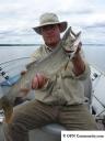
Great lakers, Pete. Thanks.