irishfield Posted March 1, 2007 Author Report Posted March 1, 2007 Yah...I was hopin she was on line to say "HEY THAT'S MY HOUSE"..but she's not. What does this peninsula of land belong to? and for bonus can anyone name the larger inland lake in the top/right quarter of the second shot.
Rob Posted March 1, 2007 Report Posted March 1, 2007 Methodist point and Little lake? Not sure who it belongs to though. Rob C
irishfield Posted March 1, 2007 Author Report Posted March 1, 2007 (edited) Nope the second shot is taken looking South/East..and you can see both Penetang and Midland Harbours in the top of the picture...heck I can even see the narrows to go into Matchedash Bay on the horizon. So now that Martin has gone to dig out his GBay Charts....in the first picture...that is Beausoleil Island in the top right qt of the picture and I'm headin East at this point.. Edited March 1, 2007 by irishfield
Rob Posted March 1, 2007 Report Posted March 1, 2007 (edited) Awenda PP Kettle lake Rob C Edited March 1, 2007 by Rob C
irishfield Posted March 1, 2007 Author Report Posted March 1, 2007 (edited) Park is correct and sorry..just grabbed my own charts and didn't realize that was called Methodist Point Figured that would be over by Methodist Island LOL. Lake is wrong though. Kettle and Pine I believe are the two lakes in the park. What is the bigger lake to the right of them. Edited March 1, 2007 by irishfield
fishforfun Posted March 1, 2007 Report Posted March 1, 2007 Dang had to climb in the attic and get my Richardsons chart book out! Rob knows his stuff other than fishing with you in the fall haven't boated this end of the bay in 10 years.
irishfield Posted March 1, 2007 Author Report Posted March 1, 2007 LOL Martin..and what did I just post... "now that Martin has gone looking for his charts..." LOL And there are two correct answers to the name of the lake in question...
Rob Posted March 1, 2007 Report Posted March 1, 2007 I love to fish around thunder bay and Christian Island, awesome salmon fishing, and very close to shore. Too bad so many poorly marked gill nets. Irish, other than Cedar Pointe, where else can you launch a boat (14') around that area? Love to start going back up there again this year, but that launch at Cedar Point is brutal. Rob C
irishfield Posted March 1, 2007 Author Report Posted March 1, 2007 Not sure where else, if any you can launch Rob. Don't think there is a launch on the Sawlog Beach end of Champlain Road. Cedar point is your only safe hope in a 14'r though with the shelter of Christian Island from the main lake The Lake in the picture is Farlain Lake or Cook's Lake for the older folks that know it. I lived on it in a cottage, without indoor plumbing, the first year we had the plant in town. Leah hand dug a tile bed, I renovated the whole place and drove a sand point well. 20 years later I wish I still had it. This Island is a favourite for bikini watchin and swimmin. Someone may wade out to you and say "$10 for mouring on Indian Land".
fishforfun Posted March 1, 2007 Report Posted March 1, 2007 Beckwith Island, spent many nights swinging on the hook there.
irishfield Posted March 1, 2007 Author Report Posted March 1, 2007 Correct Martin. These are freebees. Thunder Beach looking in and Thunder beach looking out with Christian Island left, Beckwith right and Hope Island behind it...and open water as far as the eye can see. That ship will be breakin out of Midland Harbour in no time...
walleyejigger Posted March 1, 2007 Report Posted March 1, 2007 nice pics Wayne, but..... put the camera down and keep ur eyes on the road and hands on the wheel will ya. ur freakin me out
irishfield Posted March 1, 2007 Author Report Posted March 1, 2007 LOL WJ...not much to hit up there and the airplane purdy much flies itself..or at least it seems to after 12 years in the same bird. I'm confident most here know that last picture is the longest fresh water beach...Wasaga and Woodland and Bluewater closest in the shot.. What is the name of the "bump" in the beach's curve?
GbayGiant Posted March 1, 2007 Report Posted March 1, 2007 Cool pics Wayne, you could probably take a picture directly over my home town and wouldn't know what it was. It's a whole new perspective with the birds eye view. Was there another fish under that Montreal Canadians flag ?
irishfield Posted March 1, 2007 Author Report Posted March 1, 2007 You still got that chart book out Martin? LOL Name the two islands in this shot
fishforfun Posted March 1, 2007 Report Posted March 1, 2007 Not a visible land mark but from our fall troll Present and Snake? It gets a lot tougher when arial photos are north of Parry Sound then the memory is put to the test with so many bays and Islands!
irishfield Posted March 1, 2007 Author Report Posted March 1, 2007 Yes correct..Present in the foreground..snake the little strip of trees and midland harbour in the far right. We can do the whole GB coast up to the French if you like...LOL Got a couple left. What "bay" is this
GbayGiant Posted March 2, 2007 Report Posted March 2, 2007 (edited) Just a question Wayne. Almost every day out fishing I see at least 1 or 2 planes fly over fairly low and I usually always wave. ( I'll keep an eye out for your green machine ) Do you see us waving ? I'm confident most here know that last picture is the longest fresh water beach...Wasaga and Woodland and Bluewater closest in the shot.. Grew up in the Beach area a didn't even get that one. Edited March 2, 2007 by GbayGiant
fishforfun Posted March 2, 2007 Report Posted March 2, 2007 Ok got me don't recognize it at all Sailors don't spend a lot of time on docks LOL.
irishfield Posted March 2, 2007 Author Report Posted March 2, 2007 I wing wag back to a lot of fisherman that wave. Depends where you're looking at the time I guess as to whether they'll see you or not. Still waiting on the picture above...but just for you John.. where is this?
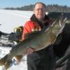
irishfield Posted March 2, 2007 Author Report Posted March 2, 2007 Ok got me don't recognize it at all Sailors don't spend a lot of time on docks LOL. I have another shot panned out that would give it away pretty quick ! It's a popular venue for early season ice fishing....


Recommended Posts
Create an account or sign in to comment
You need to be a member in order to leave a comment
Create an account
Sign up for a new account in our community. It's easy!
Register a new accountSign in
Already have an account? Sign in here.
Sign In Now