
irishfield
-
Posts
26,274 -
Joined
-
Last visited
-
Days Won
56
Content Type
Events
Profiles
Forums
Store
Everything posted by irishfield
-
What do you do when your Spouse is away?
irishfield replied to brickNblock's topic in General Discussion
Starved ! -
Sure now you tell me Mikeh ! LOL Double light there actually...or at least there was the last time I paid attention. As for the picture..no I said Georgian Bay, after you've gone well past Admiral trolling. I put the Six Mile to Gloucester in the "new boat/six mile" thread. Also note the slush in the picture. The only lake that didn't look tretcherous for slush is Six Mile..so stay on the trails if you're heading out on the lakes. ANOTHER hint for this one. Use to be an exit off hwy 69 named after this spot...
-
Yep Mike finished that one up...now go as far as you can as you continue to troll...and you'll come to where I first fished Georgian Bay 25 years ago. Waterfalls in the end of the bay.
-
-
Yep...otherwise Rob would have the whole answer.....
-
Yep...just have a path cleared by midnight on the 8th for a 6 hour period. We can care less after that.....
-
-
You bet Remo...so what's this as you continue trolling the same shoreline..
-
The advert Jingle goes..."Do you wanna, at the .........
-
Darn Paul..you want the location...not okay when I gave it to lew but now you want it..LOL Closer to say Honey Harbour...
-
Cutey Dan. Are her eyes two different colours?
-
Right idea ..not as "glamerous"! Paul...I didn't fly across Nottawasaga Bay. I'm not even that stupid in the summer...I go around it. All pictures I am posting are from a 15 mile radius of Penetanguishene.
-
Wouldn't that be nice...I'd steal something if that's the case...
-
Correct..the entrance to Owen Sound Harbour. What is this...
-
All that open water on the top side of the point is Notty bay...what is the bay on the far shoreline?
-
Joey, Joey, Joey just for you and Team 2
irishfield replied to DT10Sam's topic in General Discussion
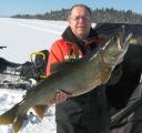
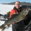
GREAT fish Sam...but Team 7's gonna wait till fall to beat that baby! -
I was just going to post a closer in shot Rob....You are correct light house point on Christian Island Native Reserve. So based on that ....what is the far shoreline dent/bay? In the top right corner of the above shot.
-
What's that Mike.....FOUR dead fish ?
-
Okay Pauls...what is the main land mark in this picture and as a bonus..what is the large bay in the far shoreline
-
Dang...now I have to come up with prizes?
-
Yes Lew..it's the Big Chute Marine Rail out of Glouster Pool into the Severn System. Severn Bridge I guess is the village. I'll finish my supper and dig up another one...
-
Nope..right idea though...
-
Managed to get out for my very first flight, since coming home with my airplane from the lake back on Aug 30th. Took 69 random shots while I was out. Thought it might be fun to post some pics and let you guess what/where it is. The first one should be pretty easy! Wayne REMEMBER TO SCROLL TO THE NEWEST PICTURE BEFORE ANSWERING
-
I couldn't resist the sunshine and lack of wind for a change.....so I went out and got you some shots. This one gives you an idea of how much you'd better give'r in the pool to get up to Six Mile. This one shows you that you'd better have a map and compass for 6 mile until you've figured out where all the fingers/bays go. Looking North This one also looking North showing the simplicity of the pool in comparison...the finger up the very left side is little go home bay.
-
I know where there's a nice prospectors tent and a plastic dock on the Montreal River! Want the coordinates?