Ramble Posted March 25, 2009 Report Posted March 25, 2009 Dad and I booked our August trip into the park. We are trying a different destination this year. The McKaskill Lake Cabin. There is about 4700m of portages to get into it. It's actually more walking then paddling lol. Should be a good time if i don't stroke out on the way in. Gotta love new lakes, and new country side. I was wondering if any of you have been into McKaskill lake or up the portages from Crotch into McKaskill. I've done the Crotch into Shirley lake portage, but haven't been through Ryan, Big Red and Shrew lakes. Any info would be great on teh portages in. Likewise any fishing information is welcome as well. -Dave
Nemo Posted March 25, 2009 Report Posted March 25, 2009 (edited) May want to post that question on Algonquin Adventures forum http://www.algonquinadventures.com/ I bet someone there will have the answer(s). Nemo Edited March 25, 2009 by Nemo
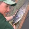
Maverick Posted March 25, 2009 Report Posted March 25, 2009 I'm a member of the Bonnechere Algonquin First Nation and we fish Ryan in the winter. There are some nice splake in there. My personal best at that lake is a 7 pounder. When you come in from Shirley you will be at the west end of the lake, we fish out front of the island on your right and down on the west side of the island on the east end of the lake. I'd have to ask my grandpa about the other lakes. He has fished those lakes for probably 65 years and knows every lake in that section of the park. I'll talk to him this weekend and see what he says about McKaskill. As far as the portages, from Crotch to Shirley it looks around 700m(not marked for some reason) and Shirley to Ryan is 515m. Then you have a 230m to a small lake, 545m to Shrew and 2355m to a tiny pond and a 40m to McKaskill.
Maverick Posted March 25, 2009 Report Posted March 25, 2009 May want to post that question on Algonquin Adventures forum http://www.algonquinadventures.com/ I bet someone there will have the answer(s). Nemo Just took a look at that site and it has a sweet map. I'll be using it this summer for sure. Thanks.
Ramble Posted March 25, 2009 Author Report Posted March 25, 2009 That maps is AWESOME. Thanks guys. I found a trip report on the site for that route. "We paddled the small lake call Dove Lake and we started the biggest portage of the day a 2355m. This portage was one of the hardest of the entire week. This portage was very hilly, with terrible terrain like walking along a mountainside. The next two lakes, Shrew and Big Red were separated by a 545m portage that was a cakewalk...." Sounds like the fishing isn't too bad in the area as well. Next up is hunting for a depth map for the lake. -Dave
Cookslav Posted March 25, 2009 Report Posted March 25, 2009 That map is acurate...very. I've not done that trek but You can certainly tell the portage from Shrew to dove will be..."character building" LOL! It pretty up and down, and then it looks like it could get a bit wet & buggy near the end.(depending on your season of course) It starts at 420M in elevation, and crests at 440M in the middle only to drop back to 390M by the time you reach Dove. No "major" hills But theres plenty of up and down inbetween. You'll have a blast regardless I'm sure.
douG Posted March 26, 2009 Report Posted March 26, 2009 I have large respect for you interior trippers. I love the park, but I'm no longer ready for that kind of commitment. And yes, I visited Shall / Shirley / Ryan, but that was almost 40 yrs ago. I know you will have a great trip, RambleOn, make sure you tell us about your adventure. Me, I'll be arriving Opeongo on Sunday, May 10. Look for a couple of 1750 ProV Lunds on the North Arm near Eric's Island or Proulx, or for the heaviest camp in the park.


Recommended Posts
Create an account or sign in to comment
You need to be a member in order to leave a comment
Create an account
Sign up for a new account in our community. It's easy!
Register a new accountSign in
Already have an account? Sign in here.
Sign In Now