
iFish4real
-
Posts
386 -
Joined
-
Last visited
-
Days Won
1
Content Type
Events
Profiles
Forums
Store
Posts posted by iFish4real
-
-
 thanks again for all Old ..I am well aware of the dangers and I wouldn't throw myself in big waves stupidly
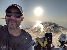
  we were in the water by 7 when wasn't too bad, went out to check 40fow and headed back after 30min to 15fow close to the rock pier ...and out by 12pm
 -
I wanna know your daughter
-
thanks for the tips Old I ...I do have a good fishfinder and we were marking lots but moving around on those crazy waves with my 14' alum Lund isn't easy
-
Thanks again for all the info!
We did go to Port Burwell Sat. morning, nasty waves all day, lots of boats out at 40' and over but nobody seamed to be cathing anything so we headed back closer to shore and caught lots 8-10" in 15fow but nothing significant around 13" or more.
the worst thing was when we left, at the marina the boat in front of us had easily over 50 of them 13" and bigger, all they told us was they went out west
-
thanks everybody, we're trying Port Burwell tomorrow morning, I'll report how it went

-
Hello fish buddies!
Anybody been out by Port Burwell or anywhere on Erie for perch lately?
Thanks a ton!
-
Thanks for posting this buddy!
-
anybody knows if the ice is still safe for walking by Big Bay Point?
info much appreciated
thanks!
-
Teaching my sun a few tricks!!

this one's priceless
-
hmmm...make's me wanna tickle the trigger
-
Comparing these two is like Ford vs GM.. One thing I've heard is that customer service from Humminbird far out does that of Lowrance.. As for the HDS7, you can get a 858c HD for $50 less at BassPro..
I've also read about the menu system on the Humminbird being quite a bit easier to use. I'll be in the market for a updated sonar this year (Currently have a 788ci), I'm thinking 898 HD SI or a 958, can't make my mind up!
well, the 958 doesn't have the side imaging, from what I hear here that's the best feature Humminbird has. It's abt $200 less, that's true
-
there's one on ebay for $1,297.99...
-
thanks guys, now I know what I'm getting
-
I'm thinking about getting a new Hummingbird for my boat. Has anybody used the new ones with Side Imaging® / Down Imaging® features (898c HD SI Combo) ? Are they worth the money or I should just go for a regular DualBeam one (858c HD XD Combo) ?
Much appreciated, thankx!!!
-
what lake you'll be fishing? afaik Marten Lake is closed for ice fishing this year...
-
Boat chartplotter/sonar doesn't have a data connection to DL satellite imagery.
well then...get an iPhone
-
I just tried on my phone's navioincs app and most of the smaller lakes north of Temagami "disappeared" as I zoomed in. So as mentioned you might just have your boats path marked on a blank screen.
Well I tried Navionics on my iPhone and it will show the satellite view map as Google maps except no depths for the lake. I used it like this last year on lake Wicksteed which isn't mapped for depths but we could still know where we were and track our way. It's kinda awsome cause I use it as a GPS for hunting too...
I'm thinking it would work the same on the boat Navionics...
-
yeah, pretty much nothing covered north of Temagami...

-
I do a lot of internet banking and purcases but this only happened to me once, my CC was charged in Italy and I've never been there
bank changed my card and wiped all charges so, I wouldn't be so worry... -
care to share what something like that costs?
yep...I'm curious too
-
checked the web site, nothing listed on sale there...
-
I heard that mountain climbers use those aluminum foil survival bags, they get in one of those first then in the sleeping bag, aluminum is know as a very good thermal insulator, will keep your body temperature in I guess...maybe you should try and let us know how it worked, they're only a few bucks and I believe even Candian Tire has them...
-
what kind of fow were u fishing in? looks pretty shallow...
-
Awesome!
Those shots through the clear ice always give me the heebie-jeebies...
yeah, we actually did pick a spot witn no snow, just black ice and water was crystal clear, we could see the fish biting 34' down...
Big Caribou Lake
in General Discussion
Posted
anybody else any info on this lake? is it worth going for a weekend?